GIS Maps & Property Information

Welcome to the Outagamie County Land Information website. Use the Parcel Viewer below to search property and tax information. Access floodplain, PLSS, historic air photos, foreclosure information, LiDAR downloads, and more from the links below.
Land Information Program
Established in 1990, the Outagamie County Land Information Committee includes representatives from multiple County departments. In 2010, it was renamed to the Outagamie County Land Information Council to align with Wisconsin statutes.
The Council is chaired by the Land Information Officer, the County's representative to the Wisconsin Land Information Program (WLIP), which provides financial and technical support for land records modernization. The Land Information Officer coordinates modernization guidelines and helps develop countywide land records modernization plans.
Land Information Plan(PDF, 2MB)
Land Information Council
- Brad Bastian, Development and Land Services- Chairperson
- Jeremy Freund, Land Conservation
- Brea Vang, Register of Deeds
- Terri Lison, Development and Land Services
- Dan Gabrielson, County Board Supervisor
- Isaac Uitenbroek, Development and Land Services
- Thomas Rooney, Realtor
- Sarah Van Camp, Register of Deeds
- Rochelle Oskey, Treasurer
- Dave Yurk, County Surveyor
- Jeff Dietzen, Sheriff's Department
- Michael Morman, Highway Department
- Darren Koutnik, IT
Custom Mapping Fee Schedule
If you would like staff to provide customized data that cannot be downloaded for free here or would like a customized digital or hardcopy map, there will be a $50.00 per hour ($25.00 minimum) charge plus paper printing costs if applicable (see below).
Municipalities and school districts can receive one free map per year (printed or digital copy) if the requested map has been created previously by the Development and Land Services Department.
Map Catalog
County Road Maps (By Fire Department District)
- Airport Extended(PDF, 2MB)
- Bear Creek(PDF, 1MB) Includes Village of Bear Creek, Town of Deer Creek and northern portions of Town of Maple Creek
- Black Creek(PDF, 1MB) Includes the Village and Town of Black Creek
- Buchanan(PDF, 1MB) Includes the western portion of the Town of Buchanan
- Center(PDF, 1MB)
- Dale(PDF, 1MB)
- Ellington(PDF, 1MB)
- Freedom(PDF, 2MB)
- Greenville(PDF, 2MB)
- Hortonville(PDF, 1MB) Includes the Village of Hortonville, the Town of Hortonia and the southeastern portion of the Town of Liberty
- New London(PDF, 2MB) Includes the City of New London, the western portion of the Town of Liberty and the southern portion of the Town of Maple Creek
- New London- Waupaca County(PDF, 1MB)
- Nichols(PDF, 1MB) Includes the Village of Nichols, the Town of Cicero and the northeastern portion of the Town of Maine
- Oneida(PDF, 2MB)
- Osborn/Seymour(PDF, 2MB) Includes the Town of Osborn and the City and Town of Seymour
- Shiocton(PDF, 2MB) Includes the Village of Shiocton, Town of Bovina, the southwestern portion of the Town of Maine and the eastern portion of the Town of Liberty
- Vandenbroek/Kaukauna(PDF, 2MB) Includes the Towns of Vandenbroek and Kaukauna
Historic Maps
Most map documents are scanned as .tiff images. You may need to choose a program to open the document. Maps courtesy: Appleton Public Library, Outagamie County Register of Deeds, and City of Appleton
- John Stephens Map 1872 of the City of Appleton(PDF, 6MB)
- Three Village Plat 1853(PDF, 4MB) (Appleton, Grand Chute, Lawesburgh)
- Oneida Reservation Original Claims and Government Lots(TIFF, 1MB)
- City of Appleton Map 1928(TIFF, 16MB)
- Town of Black Creek Map 1938(TIFF, 187KB)
- Town of Buchanan Map 1938(TIFF, 373KB)
- Town of Center Map 1938(TIFF, 147KB)
- Town of Cicero Map 1938(TIFF, 184KB)
- Town of Dale Map 1938(TIFF, 219KB)
- Town of Ellington Map 1938(TIFF, 216KB)
- Town of Greenville Map 1938(TIFF, 198KB)
- Wisconsin Township and Range Index 1963(PDF, 105KB)
- "Life on a Wisconsin Survey" 1847(PDF, 41KB)
- Outagamie County Cemetery Map Directory 2007(PDF, 5MB)
- Village of Black Creek (Estimated as 1958)(TIFF, 258KB)
- Village of Combined Locks Assessors Map 1927(TIFF, 875KB)
- City of Kaukauna Assessors Map 1890(TIFF, 7MB)
- Village of Kimberly Assessors Map 1924(TIFF, 6MB)
- Village of Little Chute Assessors Map 1917(TIFF, 1MB) This image is not the original recorded plat, the recorded plat is available in hard copy only in the Register of Deeds Office
- Outagamie County Map 1941(TIFF, 6MB)
- Village of Shiocton Jan 1951(TIFF, 754KB)
Appleton Assessor's Map 1907
Historic Photo Gallery (Appleton/Grand Chute)
- Plan part of Appleton 1867(PDF, 3MB)
- NE-1900 Assessor Plat of the City of Appleton(PDF, 12MB)
- NW-1900 Assessor Plat of the City of Appleton(PDF, 12MB)
- SE-1900 Assessor Plat of the City of Appleton(PDF, 12MB)
- SW-1900 Assessor Plat of the City of Appleton(PDF, 8MB)
- NW-SEC-27(PDF, 849KB)
- SE-SEC-27(PDF, 5MB)
- SW-SEC-27(PDF, 4MB)
- NE-SEC-34(PDF, 5MB)
- NW-SEC-34(PDF, 6MB)
- SE-SEC-34(PDF, 8MB)
- SW-SEC-34(PDF, 9MB)
- NE-SEC-35(PDF, 2MB)
- SW-SEC-35(PDF, 8MB)
- SE-SEC-35(PDF, 8MB)
- NW-SEC-35(PDF, 5MB)
- NE-SEC-36(PDF, 1MB)
- NW-SEC-36(PDF, 2MB)
- SE-SEC-36(PDF, 2MB)
- SW-SEC-36(PDF, 1MB)
- Town of Buchanan Resurvey 1883(PDF, 4MB)
- Town of Grand Chute Resurvey 1 of 2 (1869)(PDF, 2MB)
- Town of Grand Chute Resurvey 2 of 2 (1869)(PDF, 1MB)
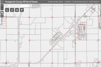 Parcel Viewer
Discover parcel related information, including addressing, assessment data, sanitary permits and much more.
 Planning & Zoning Viewer
Discover planning & zoning related information, including zoning & sanitary permits, floodplain data, shoreland zoning data, soils, general zoning districts, and much more.
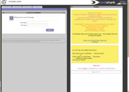 Landshark
Landshark access
 Property Search
 FEMA Floodplain Viewer
View Flood insurance rate panels, current and past floodplain boundaries, LOMAs, flood storage areas and cross sections.
 Polling Place Locator
Find your polling place (where you may vote), view your polling place's hours and get directions, see what will be on your next ballot, find your next election, learn about absentee voting.
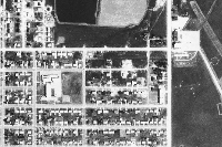 Historic Aerial Photos 1938-2025
View and compare historic aerial photography including the following years: 1938, 1957, 1964, 1970, 1980, 1992, 2000, 2005, 2010, 2014, 2018, 2021, 2023, and 2025.
 PLSS Finder
Find survey information on monuments, HARN stations, tie sheets, plat of survey records. Plat of Survey Search(PDF, 412KB)
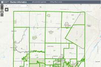 Election Information
View Election Layers (2021 Supervisory Districts, 2021 Wards, School Districts...)
 Foreclosure / Sheriff Sales
Foreclosure / Sheriff sale properties.
 LiDAR Download
LiDAR download web app. Download Bare Earth data in shapefile format. 2005 and 2018 data available.
 Mailing Label Web Application
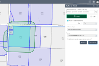
Mailing Label web app allows you to select parcels and buffer to create mailing lists and labels. Export available in csv or pdf with label style options.
 Outagamie County Highway Right of Way Plats
View plans and plats along County Highways for projects that have been completed.
 Plat Book Viewer
Plat Book Viewer was created to look like a hard copy. Outagamie County Plat Book. View and print for free.
 Residential Comp Finder
Residential Comp Finder application can be used by the general public real estate agents, and appraisers to find comparable sales and related property information
 Snowmobile Trails Web Application
Outagamie County Snowmobile Trails Interactive Web Map.